this post was submitted on 27 Mar 2024
68 points (94.7% liked)

Dungeons and Dragons

11056 readers
275 users here now

A community for discussion of all things Dungeons and Dragons! This is the catch all community for anything relating to Dungeons and Dragons, though we encourage you to see out our Networked Communities listed below!

/c/DnD Network Communities

Other DnD and related Communities to follow*

DnD/RPG Podcasts

*Please Follow the rules of these individual communities, not all of them are strictly DnD related, but may be of interest to DnD Fans

Rules (Subject to Change)

Format: [Source Name] Article Title

founded 1 year ago
MODERATORS
 

TL;DR:

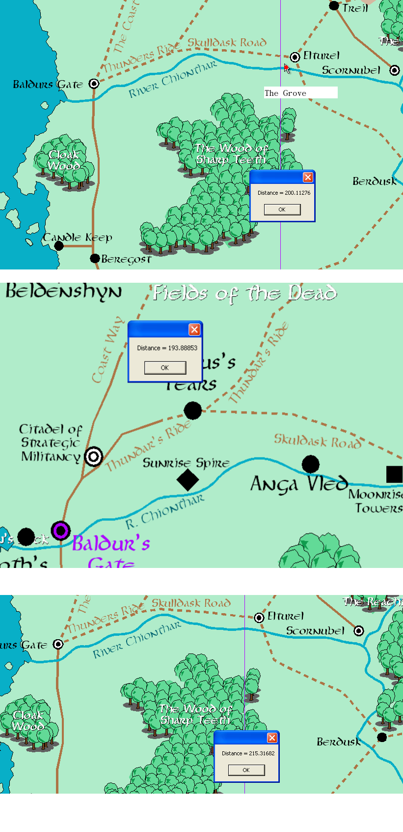
Elturel = 215 miles east of Baldur's Gate The Grove = 200 Miles East of Baldur's Gate Moonrise / Reithwin = 193 Miles East of Baldur's Gate


(Migrating accounts and reposting on TTRPG as it seems more relevant here. We're working on a more robust version of this.)

My partner and I have been trying to pinpoint the locations in Baldur's Gate 3 on the Sword Coast map.

Larian, in their Gameplay Demo, revealed two vital bits of information. First, that the nautiloid crash site was on the Chionthar and second, that it was approximately 200 miles east of Baldur's Gate. The Blighted Village, Goblin Camp, and everything else should be relatively close (within 5-10 miles) of The Grove. In-game text suggests that The Blighted Village, Moonhaven, is on the border of the lands controlled by Elturel, but where that border is or what it means is squishy.

Moonrise was more difficult. The only out-of-game reference to Moonrise was in an old adventure, and the only map we could find with Moonrise definitively mapped was in the old Forgotten Realms Interactive Access mapping tool. We got our hands on a copy and proceeded to measure distances. The results are available above.

Caveat: The maps of the Sword Coast have changed over time. Sometimes, TSR / Wizards changes distances dramatically, so this estimate is only that. Take this with a grain of salt / as a fun project we undertook to better understand how in-game locations meshed with Sword Coast locations.
top 5 comments
sorted by: hot top controversial new old
[–] mox@lemmy.sdf.org 10 points 8 months ago* (last edited 8 months ago) (1 children)

In case it helps (and for other readers interested in this stuff) here are some interactive maps:

https://loremaps.azurewebsites.net/Maps/Faerun

https://www.aidedd.org/atlas/index.php?map=R&l=1

It's important to remember that dates matter when piecing together Forgotten Realms geography, because changes are part of the lore. In particular, the first and second sundering.

https://en.wikipedia.org/wiki/The_Sundering

Also, dates have been counted using various different reference points, so a number alone isn't enough to figure out when something happened. Dale Reckoning (DR) is the most common one these days, but older maps and stories may contain dates that are offset from DR.

[–] Diotima@ttrpg.network 3 points 8 months ago

Yes, Wizards does like to play fast and loose with the geography especially between editions. Our efforts are best effort using what we have on hand (or the stuff we buy;) the only other official depiction of Moonrise Tower we could find, for example, was in the FRIA which (I believe) is a late 2E / early 3E map. We're only 80% convinced that they're the same tower for in-game reasons. Regardless, we assumed it was, mapped from there.

[–] YoFrodo@lemmy.world 5 points 8 months ago
[–] Rigal@lemmy.world 2 points 8 months ago (1 children)

What software are you using for the map mapping.

[–] Diotima@ttrpg.network 1 points 8 months ago

The Forgotten Realms Interactive Atlas. Its been discontinued for a while so eBay is prob your best bet.